Aug 20, 2024 / Regulation / 3 min read
LAANC in Atlanta: Getting Authorization Around Hartsfield-Jackson
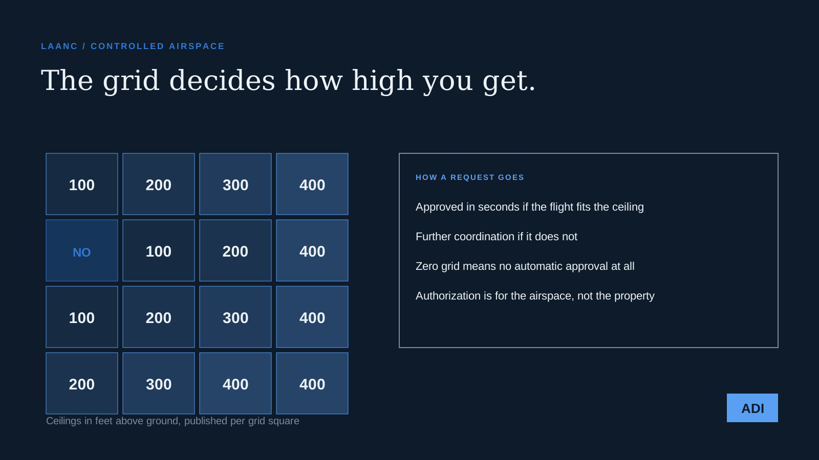
People are often surprised at how much of Atlanta requires permission before a drone leaves the ground. Hartsfield-Jackson is the busiest airport in the world and its controlled airspace reaches well beyond the fence line, and that is before you count Peachtree-DeKalb, Fulton County, Cobb County, Gwinnett, and the smaller fields around the metro.
The good news is that most of that permission is granted in seconds. The important part is understanding when it will not be.
What LAANC is
The Low Altitude Authorization and Notification Capability is an automated system that sits between remote pilots and air traffic control. The FAA publishes a map of grid squares over controlled airspace, and each square carries a maximum altitude that air traffic control has agreed in advance can be approved without a human looking at it.
Request a flight at or below that ceiling through an approved app, and the authorization comes back almost immediately. It is genuinely one of the better pieces of aviation software, which is not a phrase anyone uses often.
Reading the grid
The ceilings step down as you approach a runway. Out at the edge of the surface area you may see four hundred feet, which is the regulatory maximum anyway. Closer in it drops to three hundred, two hundred, one hundred. Directly under the approach path you will find squares marked zero.
Zero does not mean the flight is banned forever. It means no automatic approval, and any flight there needs a further coordination request that a human at the facility reviews. Those take time, are often refused, and should never be planned as though they were routine.
What this means in practice around town
Downtown, Midtown and Buckhead sit under airspace that requires authorization, but the ceilings there are usually workable for commercial photography. South of the city, closer to the airport, the grid tightens quickly, and a site that looks unremarkable on a map can turn out to sit under a hundred foot ceiling. A hundred feet is enough for a roof inspection and not enough for a skyline establishing shot.
The suburbs north of the perimeter are mostly uncontrolled, which is why so much residential work there is straightforward. Even then, a temporary restriction can appear over a site with very little notice, which is what happens on game days downtown.
What authorization is not
Two misunderstandings cause most of the trouble. Airspace authorization is permission from the FAA to use the airspace. It is not permission from a landowner to be over their property, not permission from a city to launch from a park, and not a defence against a venue's own rules. We still get property permission separately, every time.
And an authorization is for a specific place, altitude, and window. It is not a season pass. Turning up on a different day and flying under last week's approval is a violation even if nothing about the site has changed.
How we handle it
Airspace is checked when a job is quoted, not on the morning of the shoot. If a site needs further coordination we start it weeks out and we tell the client immediately, because the honest answer sometimes is that the shot they want is not available at that altitude at that address. Finding that out during the quote is inconvenient. Finding it out with a crew on site is expensive.
If you have a location in mind and want to know what the airspace allows there, send us the address. Checking it takes us a few minutes and it costs you nothing.